

A biome map of North America is more than a guide to forests, deserts and grasslands. It is also a useful framework for understanding how water moves, where ecosystems are most vulnerable and why PFAS pollution does not affect every region in the same way.
From the Arctic tundra to the tropical wetlands of southern Florida, North America contains an extraordinary range of ecological systems. Each biome has its own climate, soils, vegetation and water cycle. These features influence how persistent chemicals travel through rivers, groundwater, wetlands and coastal waters.
PFAS—per- and polyfluoroalkyl substances—are often described as “forever chemicals” because many of them resist natural degradation. Their behaviour is complex: some move readily with water, while others attach to sediments, organic matter or biological tissue. Reading a biome map alongside a water-quality map can therefore reveal important patterns that are easy to miss when pollution is considered only by political borders.
What does a biome map show?
A biome is a broad ecological region shaped primarily by climate, temperature and precipitation. A standard North American biome map commonly identifies several major zones:
- Arctic and alpine tundra
- Boreal forest, also known as taiga
- Temperate deciduous and mixed forests
- Temperate grasslands and prairies
- Deserts and semi-arid shrublands
- Chaparral and Mediterranean-type ecosystems
- Tropical and subtropical forests
- Wetlands, coastal ecosystems and aquatic environments
These categories are broad. A single state or province may contain multiple biomes, and conditions can change significantly over short distances. Elevation, geology, land use and proximity to the coast also matter.
For water-quality analysis, the most valuable feature of a biome map is that it provides ecological context. A PFAS release into a dry desert basin will behave differently from one entering a peat-rich boreal wetland or a fast-flowing mountain river. The chemical itself may be persistent in all three settings, but its transport, dilution and ecological consequences can differ sharply.
North America’s major biomes and their water systems
Arctic tundra
The Arctic tundra stretches across northern Alaska, northern Canada and Greenland. It has low temperatures, short growing seasons and permanently or seasonally frozen ground. Lakes, ponds, rivers and wetlands are common, but their hydrology is strongly controlled by snowmelt and permafrost.
Climate change is altering this system. As permafrost thaws, water pathways can change and previously trapped contaminants may become more mobile. PFAS can reach Arctic environments through atmospheric transport, ocean currents, long-range movement of products and local activities such as military operations, airports and waste handling.
Although PFAS concentrations in remote Arctic waters may be lower than those near industrial sources, “remote” does not mean chemically isolated. Persistent substances can travel long distances, and cold-region ecosystems may be particularly sensitive because food webs are relatively simple and recovery can be slow.
Boreal forest
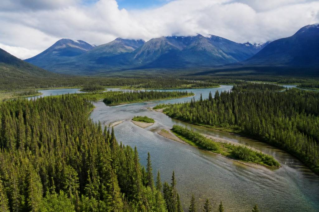
The boreal forest forms a vast band across Canada and Alaska. It contains coniferous forests, lakes, rivers, peatlands and extensive wetlands. Organic-rich soils and peat can interact with PFAS in complicated ways, retaining some compounds while allowing others to move into surface water.
Wildfires create an additional concern. Research has shown that the combustion of PFAS-containing materials can produce or redistribute fluorinated compounds, depending on the conditions and the materials involved. Firefighting activities may also introduce PFAS through the use of aqueous film-forming foams, particularly around airports, military facilities and industrial sites.
When fire affects a watershed, ash, erosion and stormwater can transport contaminants into streams and lakes. In a forested environment, the risk is not limited to the original release point. Seasonal runoff can connect distant parts of the catchment.
Temperate forests
Temperate deciduous and mixed forests cover much of the eastern United States and parts of southern Canada. These regions contain dense river networks, reservoirs, wetlands and highly populated watersheds.
PFAS contamination in temperate forest regions is often linked to a combination of industrial activity, landfills, wastewater treatment, airports, firefighting training and the application of contaminated biosolids. Wastewater treatment plants can remove some PFAS from water, but conventional treatment does not reliably destroy these chemicals. Instead, PFAS may remain in treated effluent or become concentrated in sewage sludge.
Heavy rainfall and flooding can increase the movement of PFAS between soil, surface water and groundwater. A landfill located several kilometres from a river may still affect that river if the site is connected through groundwater or stormwater drainage.
Grasslands and prairies
The Great Plains extend from the Canadian Prairies through the central United States and into northern Mexico. These grassland systems are shaped by seasonal rainfall, drought, fire and grazing. Their rivers and aquifers support agriculture, cities and industry.
PFAS can enter prairie watersheds through industrial discharge, wastewater reuse, landfill leachate and contaminated agricultural inputs. The region’s large agricultural areas make the movement of chemicals through soil and irrigation systems especially important.
Groundwater is a critical resource in the Great Plains. The High Plains Aquifer, which includes the Ogallala Aquifer, supports drinking water supplies and irrigation across a large area. Where PFAS enters groundwater, remediation can be technically difficult and expensive. Contamination may persist for decades because groundwater moves slowly and many conventional treatment methods address the water at the point of use rather than removing the source.
Deserts and semi-arid regions
The deserts of the southwestern United States and northern Mexico receive little annual rainfall, but water remains central to life, cities and industry. Rivers such as the Colorado and Rio Grande are heavily managed, and groundwater often provides essential backup supplies.
In dry climates, limited rainfall may appear to reduce chemical transport. However, contaminants can accumulate in soils, sediments, wastewater ponds and low-flow waterways. Intense rainfall events can then produce sudden pulses of runoff, carrying pollutants into washes, reservoirs and rivers.
Water recycling is increasingly important in arid regions. Advanced treatment can reduce PFAS concentrations, but the effectiveness depends on the technology, the specific PFAS present and the quality of monitoring. Reverse osmosis and activated carbon are commonly used approaches, although they generate concentrated waste streams that still require careful management.
Chaparral and Mediterranean ecosystems
California’s chaparral and Mediterranean-type ecosystems experience wet winters and hot, dry summers. Urban development, drought and wildfire place significant pressure on watersheds.
Wildfire-fighting foams containing PFAS have historically been used in training and emergency response. Fire stations, airports and military facilities may therefore represent important points for investigation. After a wildfire, changes in vegetation and soil structure can increase erosion and alter the movement of contaminants into streams and reservoirs.
California’s experience also illustrates why water quality cannot be separated from water scarcity. When supplies are limited, communities may depend more heavily on recycled water, groundwater or smaller local sources. Monitoring must keep pace with these changes, particularly where drinking-water sources are close to known PFAS sites.
Tropical and subtropical ecosystems
Southern Florida, the Gulf Coast, southern Texas, Hawaii and parts of Mexico contain tropical or subtropical ecosystems. These areas include mangroves, marshes, coral reefs, rivers and shallow groundwater systems.
High rainfall, flooding and hurricanes can move PFAS through urban and industrial landscapes. Coastal wetlands may capture pollutants temporarily, but they are not guaranteed to destroy them. Tidal exchange can redistribute contaminants between freshwater, sediments and estuaries.
Mangroves and wetlands provide valuable ecological services, including flood protection and habitat for fish and birds. If PFAS accumulates in sediment or organisms, exposure may extend through the food web. This matters for wildlife and for communities that rely on fishing, shellfish harvesting or subsistence resources.
Why biome boundaries matter for PFAS pollution
PFAS pollution is shaped by three connected factors: the source, the pathway and the receiving environment. A biome map helps explain the third part of that equation.
Consider a simple example. An airport located beside a wetland may release PFAS through historical firefighting activities. The wetland could slow water movement and trap contaminated sediment, but it may also provide a route into fish, amphibians and downstream rivers. In contrast, the same release on highly permeable ground in an arid region could move rapidly into groundwater after a major storm.
Important environmental variables include:
- Rainfall and runoff: intense precipitation can transport PFAS from soils, roads and developed areas into waterways.
- Soil composition: clay, sand, peat and organic matter influence how PFAS is retained or released.
- Groundwater depth: shallow aquifers are generally more exposed to surface contamination.
- Wetlands: wetlands can retain contaminants, but they can also transfer them through connected surface-water and groundwater systems.
- Temperature: colder conditions may slow some processes, while climate-driven changes can alter chemical transport and ecosystem stress.
- Food-web structure: persistent contaminants may move from water and sediment into invertebrates, fish, birds and mammals.
These factors explain why two communities with similar PFAS levels in source water may face different ecological risks. The surrounding habitat, species present and human dependence on the water all influence the potential impact.
PFAS sources across the continent
PFAS are not associated with one single industry. They have been used in stain-resistant textiles, non-stick products, food packaging, industrial processes, electronics and firefighting foams. Many consumer and industrial applications have changed, but older contamination remains in soil, groundwater and infrastructure.
Common sources include:
- Airports and military bases where firefighting foams were used
- Manufacturing facilities and industrial parks
- Landfills receiving PFAS-containing products
- Wastewater treatment plants and biosolids application sites
- Textile, paper, metal-plating and chemical production facilities
- Fire-training areas and emergency-response sites
- Contaminated stormwater from urban and industrial surfaces
PFAS monitoring has also demonstrated that contamination is not limited to highly industrialised landscapes. Low concentrations can be detected in rainfall, rivers, groundwater and remote environments. This does not mean every location has the same risk, but it does show why consistent testing matters.
Water quality indicators to watch
PFAS should be assessed alongside broader water-quality data. A river with low PFAS concentrations may still be under stress from nutrients, pathogens, metals, sediment or low dissolved oxygen. Multiple pressures can interact, making ecosystems less resilient.
Useful indicators include:
- PFAS concentrations in raw and treated drinking water
- Individual compounds, including PFOA and PFOS, rather than only a total PFAS figure
- Levels in groundwater, surface water, sediment and fish tissue
- Seasonal changes following rainfall, flooding or drought
- Land-use patterns within the watershed
- Results from private wells as well as public water systems
Testing methods and reporting limits also matter. A result reported as “not detected” does not necessarily mean that PFAS are absent; it means they were below the laboratory’s detection capability. Comparing results is most meaningful when laboratories use validated methods and clearly report units, detection limits and the compounds tested.
How biome maps can support better monitoring
Mapping tools can help regulators, researchers and communities identify where monitoring resources are most urgently needed. Combining biome, watershed, land-use and PFAS-source maps can reveal potential connections between contamination and ecological vulnerability.
For example, priority monitoring may be appropriate where:
- A known PFAS source lies upstream of a drinking-water intake
- Groundwater supplies are shallow or heavily used
- Wetlands connect contaminated land to rivers or coastal waters
- Communities rely on private wells that are not routinely tested
- Fish consumption is important for cultural, recreational or subsistence reasons
- Flooding or wildfire may remobilise historic contamination
Maps are not a substitute for sampling. They are a way to ask better questions: Which pathways are plausible? Which communities may be exposed? Which habitats could store or redistribute PFAS? And where would early intervention prevent the greatest harm?
What communities can do
Residents concerned about PFAS can begin by checking whether their water provider publishes PFAS monitoring data. People using private wells may need to arrange independent testing, especially if the property is near an airport, landfill, industrial facility, military site or fire-training area.
It is also important to understand treatment claims. Standard household filters are not equally effective against PFAS. Certified activated-carbon and reverse-osmosis systems may reduce certain compounds when correctly installed and maintained, but cartridges require replacement and treated water must be monitored. A filter that is not maintained can become a false reassurance.
At the policy level, effective protection requires source control, transparent reporting, improved chemical management and long-term monitoring. Removing PFAS from drinking water is valuable, but preventing new releases is more durable and usually less expensive than treating widespread contamination after it occurs.
A changing map of environmental risk
North America’s biomes are not static. Warming temperatures, altered precipitation, wildfire, permafrost thaw, coastal flooding and urban expansion are changing how water moves through ecosystems. These changes may also alter the distribution and concentration of PFAS.
Understanding that relationship is essential. A biome map shows where ecological systems exist; a watershed map shows how water connects them; PFAS data shows where persistent contamination may be travelling. Used together, these tools provide a clearer picture of environmental risk—and a more practical basis for protecting drinking water, wildlife and public health.
PFAS pollution is a continent-wide challenge, but solutions begin locally: identify sources, test vulnerable waters, protect sensitive habitats and make decisions based on reliable evidence. Geography does not determine the future of a watershed. The quality of monitoring and the speed of action can.